Drone and UAV Technology Reviews, Articles, News, Build Logs
After a ton of research on FPV (first person view) video goggles I finally made the decision to go with the Fatshark HDO. I’m diving into the world of flying FPV quadcopters designed for speed, agility and acrobatics. This is a departure to the world I’ve been in with large GPS based, auto-leveled quadcopters and hexacopters.
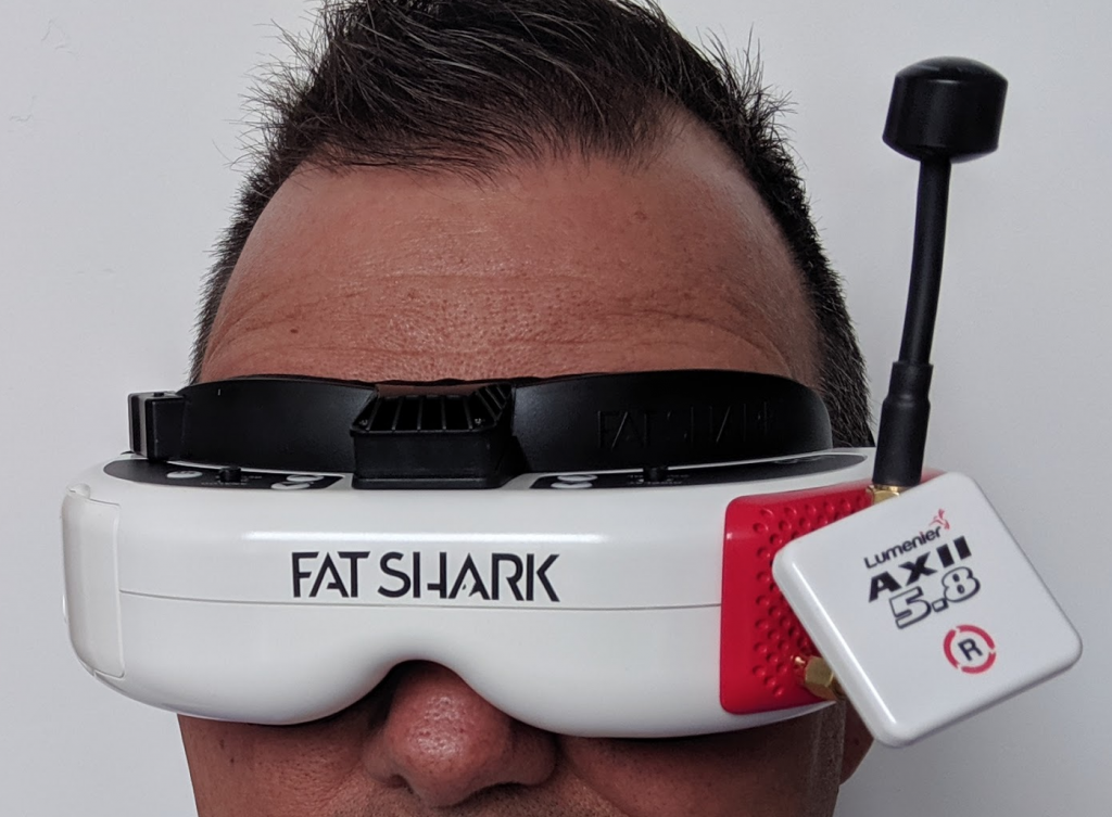
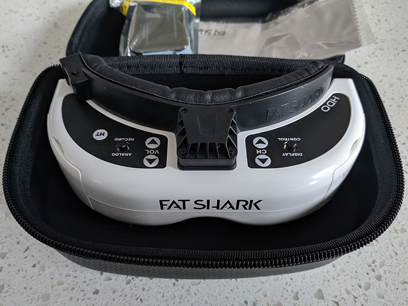
The HDO is Fatshark’s “flagship” FPV goggles. They feature a new OLED display technology which produces more vivid colors, sharper images, and higher contrast ratios than other goggles.
In addition to simply being goggles, they have a built in DVR, cooling fan, rechargeable USB battery, carrying case, and more.
Not In The Box
Not included with these goggles is a receiver. So along with the goggles I chose the Lumenier rapidFIRE diversity module (red part with antennas in photo above). I’ll be reviewing that as well.
I’m in the midst of putting together the best setup and testing. Stay tuned for the full review soon.
I’ve been away from building/flying for quite awhile. Many factors were involved in my time away from flying, mostly “life” things like kids, moving, changing jobs and so forth. But I’m back in a space with all that where I can dedicate some time to flying and building again. So the first task is to try and get all of my existing drones working again.
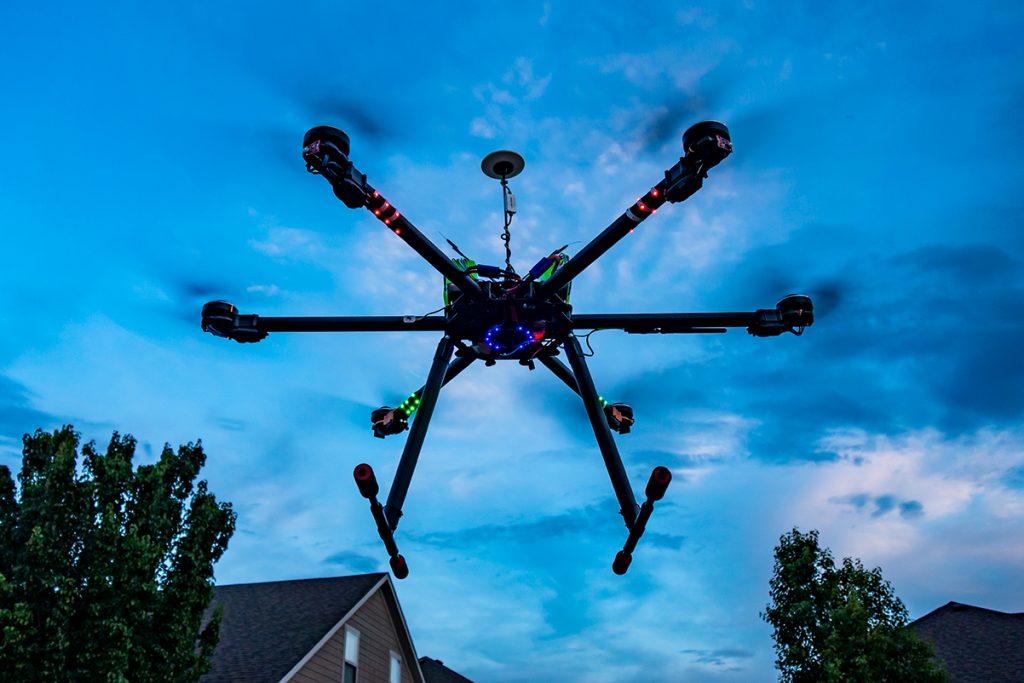
I had to do some wiring maintenance before I was willing to try and fly this large, 960 hexacopter. In storage some of the wiring had come loose. So it took me a couple of days of finding old tools, solder, flux and the rest to make the fix. I finished that work off yesterday and did some final props-off checking. I also had to remember how to work my Taranis X9D remote!
I was nervous and had forgotten that the left aileron didn’t snap into a default position, so the altitude of the craft is always touchy, a.k.a. responsive.
I didn’t fly with the gimbal and expensive camera equipment on it yet, just in case. The flight was successful. I did a smooth landing and one more takeoff, hover and landing. I see that some of the LEDs are burned out and I’ve planned to replace those anyway.
I’m back in the air!
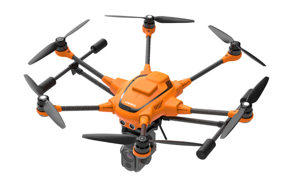
YUNEEC EXPANDS H520 LINE WITH PRECISE RTK SATELLITE NAVIGATION
Real Time Kinematic technology enables users to capture centimeter accurate data
CORONA, Calif. (Jan. 31, 2019) – Yuneec International, a global leader in electric aviation, today announced that its commercial hexacopter, the H520, will now optionally be available with an RTK (Real Time Kinematic) system from the Swiss company Fixposition. Even under difficult GPS conditions, such as in cities or canyons, the RTK system ensures maximum precision and centimeter-precise positioning. The fully integrated RTK satellite navigation enables extremely accurate recurring images, faster 3D mapping and makes automated inspection flights easier and more precise.
The new H520 RTK is perfectly suited for commercial applications that require maximum precision. By using RTK technology, the H520 can now fly much closer to objects for inspection as the UAV positions itself precisely in the centimeter range (1 cm + ppm horizontal / 1.5 cm + ppm vertical) rather than in the meter range, which is standard for the H520. This accuracy is paramount for applications where several images need to be taken at the same location on different days including: documenting progress on construction sites, inspecting mountain landscapes to prevent natural hazards such as rock falls or avalanches, and forensic accident scene reconstruction. In addition, the satellite navigation system makes it possible to significantly reduce image overlaps, which means fewer photos and shorter model calculation times, maximizing efficiency in workflows.
The RTK system is not only fully integrated into the hardware, but also into the UAV’s software. This means the user retains the full range of functions of the award-winning DataPilot™ software at their disposal, including mission flights. The H520 RTK works with two components: the RTK module on board the H520 and a base station on the ground. For precise navigation, the module supports constellations of up to three different satellite systems from GPS, GLONASS, Galileo and BeiDou.
If the use of a ground station is not possible, the system can also be operated with a national reference station network (network RTK). The network RTK is provided by third-party providers and requires an Internet connection, such as a mobile hotspot. All data including satellite data is recorded, which makes the H520 RTK ideal for Post Processed Kinematics (PPK).
The H520 RTK will be available in the second quarter of 2019 in different configurations: as a complete system including the H520 airframe and RTK module, for $3199, and as an upgrade for existing H520 customers for $1699. The H520 RTK GPS ground station will be sold separately for $2399.
-more-
The complete technical data of the Yuneec H520 with RTK system can be found at us.yuneec.com/h520-rtk.
For more information, please visit us.yuneec.com.
About Yuneec International Co. Ltd.
Founded in 1999, Yuneec is a global leader in electric aviation. Its passion for innovation is deeply rooted in the company and is reflected in hundreds of patents. The core technologies of Yuneec include manned aircraft, remote controlled model aircraft and drones for commercial and private use. Yuneec has branches in North America, Europe and Asia, producing over one million products a year for a broad customer base. From the Typhoon series for the enthusiast to the H520 platform for commercial applications, Yuneec continues to innovate, making aerial photography and data collection attainable for every pilot, regardless of previous flight experience.